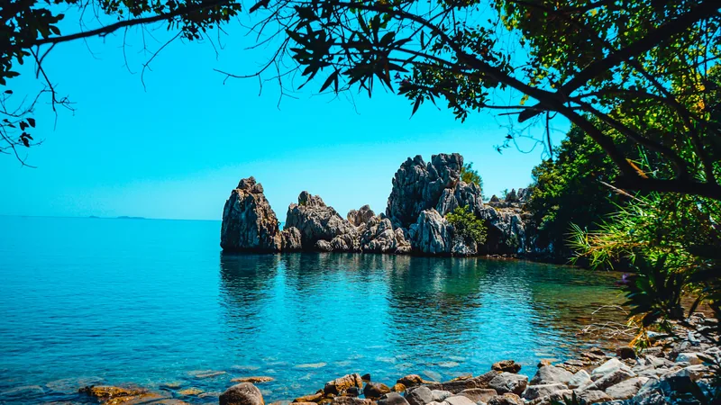
Walk the western half (Fethiye → Patara) over 7–10 days in April or October. Start in Faralya. Sleep in family pensions. Don’t bring a tent.
Most first-timers think they should walk end-to-end. Don’t. The western 150 km has the most-photographed cliff-coast paths, the highest density of Lycian sites you reach on foot, and the best pension network — meaning you can walk hut-to-hut without a tent, eat home-cooked food every night, and finish at Patara’s 12-km beach. The eastern half (Demre → Antalya) is wilder, harder, requires more wild-camping, and is best walked by people who already know they love this trail. The mistake most people make is starting in Hisarönü/Ovacık (the official start) — a steep climb out of a forgettable holiday strip into a featureless first stage. Skip that. Start in Faralya instead.
What the Lycian Way actually is
Kate Clow, a British expat living in Antalya, mapped and waymarked the trail in the late 1990s — connecting fragments of pre-existing donkey paths, pilgrimage routes, and goatherd tracks along the Lycian coast. The trail follows the coastline from Fethiye in the west to Antalya in the east, passing through 30+ ancient Lycian cities — places that were significant before Rome existed, abandoned 1200–1500 years ago, and now lie half-buried in pine forest above empty bays.
Officially: 540 km in 29 stages, waymarked with red-and-white painted blazes (the European GR standard). In practice the “trail” is several routings on most stages — coastal vs inland, easier vs harder — and most hikers mix and match. The official guidebook (Kate Clow, The Lycian Way: Turkey’s First Long-Distance Walk, 5th edition 2024) is the single best resource and the only one local guides use. The companion online platform is lycianway.co.uk — stage-by-stage descriptions, downloadable GPX tracks, pension lists, and a planning app for offline use on the trail.
It is not a wilderness trail. You pass villages most days. There’s a phone signal almost everywhere. Most stages have a tea house or a pension at one or both ends. Wild-camping is needed on roughly 3–5 stages out of 29 — on the others you can sleep indoors.
The 6 highest-leverage sections (if you can’t walk the whole thing)
Section-walking is how 80% of foreign visitors actually do the Lycian Way. You pick one or two of these blocks, base out of pensions in the trail villages, and walk a different stage each day. None of these need wild-camping.
1. Faralya → Kabak → Aşağı Sıdyma → Pydnai → Patara (the “classic 7”)
The single most-walked section. Starts above Faralya village (1 hr dolmuş from Fethiye), drops to Kabak Valley on Day 1, rejoins the high coast for Day 2, then descends inland through old Lycian villages on Days 3–4 before finishing at Patara — Lycia’s ancient capital plus the 12-km beach. Pensions every night (€30–60 incl. dinner + breakfast). Best in late April / early May or mid-October. Daily highs 22–26°C; you’ll swim every afternoon.
2. Patara → Kaş → Üçağız → Demre (the Kekova approach)
Lower-altitude than the Faralya block, very walkable in shoulder season including March and November. Highlight: Day 4 is Üçağız to Aperlae, ending at a swim-only-accessible Lycian site over a sunken Roman port. Stay in family pensions in Kaş, Üçağız, and Demre. Pair with a Kekova kayak day on a rest day.
3. Demre → Finike → Adrasan → Olympos (the eastern-coast block)
Rougher than the western half — fewer pensions, longer stages, more route-finding. But: this block passes Sura, Andriake (ancient Lycia’s main port), and finishes in Olympos village which has a treehouse-hostel scene. The Adrasan → Olympos coastal stage is one of the trail’s flagship days.
4. Olympos → Çıralı → Mt Tahtalı → Ulupınar (the Tahtalı assault)
Tahtalı (the ancient Mount Olympos) towers 2,365 m above the coast. The trail passes its base; a side-route summit is a long, hard day with 1,800 m of altitude gain and best done supported. Lower stages are easier. Don’t attempt before mid-May or after mid-October — there’s snow up high.
5. The Lycian sites cluster: Tlos · Pinara · Sidyma · Patara · Xanthos · Letoon
Most of the trail’s most-significant Lycian cities lie within a 30-km cluster reachable from a Patara or Kalkan base. Several are linked by official trail; others by short dolmuş hops. You can do this as a low-mileage cultural week with no wild-camping and the option to sleep in a Patara beach pension every night. Pair with a guided archaeology day.
6. The Yediburunlar warning
The “Seven Capes” section between Faralya and Sıdyma is dramatic on the map and brutal in person — exposed limestone, no shade, cisterns sometimes dry, fire damage from 2021. Skip in summer. In April or October it’s the most spectacular cliff-coast walking on the trail; in July it’s a heat-stroke risk. Don’t do this section first; do it once you know your pace.
End-to-end: 25–30 days, west to east
Walking the whole thing is a serious undertaking — typically 25–30 walking days plus 2–3 rest days. Most end-to-enders walk west to east (Fethiye → Antalya) because the eastern stages get progressively wilder and you build trail-fitness on the easier western coast. A few walk east to west (Antalya → Fethiye) to finish at the easiest section as fatigue sets in; that’s a defensible choice.
| Stage | From → To | km | Difficulty | Sleep |
|---|---|---|---|---|
| 1 | Ovacık → Faralya (alt: skip to Faralya) | 17 | moderate | Faralya pension |
| 2 | Faralya → Kabak | 10 | moderate | Kabak eco-camp |
| 3 | Kabak → Aşağı Sıdyma | 22 | hard | Sıdyma village pension |
| 4 | Aşağı Sıdyma → Letoon | 20 | moderate | Letoon / Pydnai |
| 5 | Letoon → Patara | 16 | easy | Patara village pensions |
| 6 | Patara → Kalkan | 16 | moderate | Kalkan harbour |
| 7 | Kalkan → Kaş (Bezirgan inland) | 22 | moderate | Kaş pensions |
| 8 | Kaş → Limanağzı → Apollonia | 16 | easy | Apollonia village |
| 9 | Apollonia → Üçağız (Kekova) | 14 | easy | Üçağız harbour |
| 10 | Üçağız → Aperlae → Üçağız (loop) | 16 | moderate | Üçağız harbour |
| 11 | Üçağız → Demre | 20 | moderate | Demre town |
| 12 | Demre → Andriake → Finike | 22 | moderate | Finike pension |
| 13–17 | Finike → Adrasan → Olympos (mountain stages) | ~85 | hard | mix: pension + 1 wild-camp |
| 18 | Olympos → Çıralı → Mt Chimaera | 11 | easy | Çıralı pension |
| 19–22 | Çıralı → Tahtalı → Tekirova → Phaselis → Göynük | ~70 | moderate-hard | pensions + Tahtalı option |
| 23–29 | Göynük → Geyikbayırı (Antalya) | ~115 | moderate | mountain pensions, 1–2 wild-camps |
Distances and stage counts vary slightly between editions of Kate Clow’s guidebook and the official trail association maps. Above is a representative breakdown; expect days where you walk shorter and days where you walk further depending on accommodation availability. For the live stage-by-stage breakdown with maps, GPX tracks, elevation profiles and pension contacts, use lycianway.co.uk.
Accommodation: pensions, eco-camps, and the 3 stages where you’ll camp
The single most-asked planning question: do you need a tent? Short answer — no, on the western half. Yes, on parts of the eastern half, unless you arrange transfers.
Family pansiyons (€25–50/night)
The backbone. Faralya, Kabak, Patara, Kaş, Üçağız, Demre, Adrasan, Olympos, Çıralı, Tekirova all have multiple family-run pensions priced €25–50/night including dinner and breakfast. The dinner is real food (not a tourist set menu) — soups, mezes, grilled fish, family-recipe desserts — and is one of the actual highlights of the trail. Booking ahead is recommended in April–May and October peak weeks; walk-in works in shoulder months.
Eco-camps (€40–80/night)
Kabak Valley has a cluster of 4–5 eco-camps (Olive Garden, Turan Hill Lounge, Reflections, Sultan Camp) with platform tents, beach access, and proper kitchens. €40–80/night including meals. Atmosphere skews younger / yoga-retreat. See the retreat directory for current openings.
Tea houses + village rooms (€15–30/night)
Half a dozen villages along the trail (Bezirgan, Aperlae, Çukurbağ, Beycik, Geyikbayırı) have a tea house or a single pensiyon offering a basic room — sometimes just a bed in a family home — for €15–30 incl. an evening meal. Negotiate in person, in the village, in cash. The single most economical way to walk the trail.
Wild-camping
Necessary on roughly 3–5 stages out of 29: typically Yediburunlar, parts of the Bel-Tahtalı approach, and the high section above Demre. Not technically illegal in most of the route corridor but please leave no trace, don’t light fires (extreme risk in summer), and ask permission if camping near a village. A 1.2 kg tent and a 0.7 kg sleeping bag handle the few wild-camp nights without dragging your pack weight up for the rest of the trail.
Water, food, and what to actually pack
Footwear: trail runners, not boots
The trail surface is limestone slab, pine-needle path, and cobble. Heavy boots are overkill and overheat in May–October temperatures. Trail runners with a stiffer shank (Salomon Speedcross, Hoka Speedgoat, La Sportiva Bushido) are what most experienced trail walkers wear here.
Pack: 35–40 L
Pension-to-pension means you don’t carry a sleeping system except on wild-camp nights. 35–40 L is enough for clothes, layers, water, snacks, plus a 1.2 kg tent + 0.7 kg sleeping bag in compression sacks if you’re going east of Finike.
Layers: sun + cold
April/October has 25°C noons and 8°C dawns. Wide-brim sun hat, sun shirt, sun cream, sunglasses. One light fleece + a packable shell for evening + a beanie for the high stages.
Navigation: GPX + the Kate Clow book
Free GPX tracks for every stage are on lycianway.co.uk — load into Gaia GPS, maps.me or the official app. The Kate Clow guidebook is the fall-back — pension owners and locals know it on sight. Don’t rely on Google Maps; many trail sections aren’t in their dataset.
First aid: blisters and ankles
Compeed, micropore tape, elastic ankle support, ibuprofen, electrolyte sachets. The terrain is rolled-ankle territory — the limestone is the third-most-rolled-ankle surface among long trails (after the GR20 and the Pyrenean Way).
Phone + battery
Turkish SIM (€10 prepaid Türk Telekom or Vodafone, get it at the airport on arrival) for emergencies and route checks. Signal is patchy but present on most stages. A 10,000 mAh power bank covers a 3-day no-pension stretch.
How to get to the trail (and home from it)
Most foreign walkers fly into Dalaman (DLM) for the western half or Antalya (AYT) for the eastern half. Both airports are ~75 minutes from the nearest trailhead.
Western start (Faralya / Ovacık / Patara)
Dalaman (DLM) takes seasonal direct flights from London (LGW/STN), Manchester, Berlin, Amsterdam, Paris CDG. Arrival to Faralya pension: airport shuttle to Fethiye otogar (1 hr, £5–8) → dolmuş Fethiye → Faralya (1 hr, £2). Or pre-book a private transfer door-to-pension for €60–90. See the transfer directory for current pricing.
Eastern start / finish (Antalya / Geyikbayırı)
Antalya (AYT) is Turkey’s busiest tourist airport with daily flights from London, Manchester, Berlin, Amsterdam, Moscow, Kyiv, plus a domestic hub. Havaş airport bus to Antalya otogar (30 min, £3) → dolmuş or pre-arranged transfer to the eastern trailhead. Finishing at Geyikbayırı: the same in reverse.
Trailhead-to-trailhead transfers
The single best service most independent walkers don’t know about: pre-arranged trailhead transfers. If you finish a section in Patara on Tuesday and want to start a new section in Üçağız on Wednesday, you can get a driver to pick you up at the Patara pension and drop you at the Üçağız pension for €40–70. See operator listings for door-to-trail transfers between every major Lycian Way village.
Guided journeys vs walking independently
Both work. The choice is mostly about what you want to think about during the days.
Independent
Cheaper (€700–1,200 for a 7–10 day section incl. accommodation, food, transfers, no flights). You navigate, you book, you carry. The Lycian Way is well-waymarked enough for confident solo trekkers, including women solo (the trail has a deserved reputation for being safer than most European long-distances).
Self-guided supported
You walk solo or as a pair, but a local operator pre-books your pensions, moves your luggage between them, and provides a phone-in support line. €80–130/person/day. You walk with a daypack only. Most popular format for first-timers, couples on honeymoon trips, and walkers in their 60s. See multi-day guided journeys on the directory.
Fully guided group
A guide leads a group of 4–10 walkers; everything is sorted. €110–180/person/day. Best for solo walkers who want company, walkers who want to learn the archaeology along the way, and walkers nervous about navigating alone. See accredited Lycian Way guides on the directory.
The mistakes first-timers make
Walking in summer
The single biggest cause of bailed Lycian Way trips. June–September daily highs of 35–42°C make the harder stages dangerous; lower stages are walkable in early morning only. Walkers who walked the trail in mid-July report it as the worst hiking experience of their lives. Walk in April–May or October–November, full stop.
Starting at the official trailhead
The official western start is Hisarönü (also written Ovacık) — the British-package-tour holiday strip above Fethiye. Stage 1 is a 600-m climb out of it, on a road, into a forgettable plateau. Skip it. Take the dolmuş from Fethiye to Faralya and start there. You miss nothing.
Underestimating the heat-rock
Limestone radiates. By 11am the trail surface is 50–55°C in summer. Even shoulder-season sun can produce real heat fatigue. Sun hat + sun shirt + sunscreen + 2× the water you think you need.
Carrying camping gear you don’t use
Western-half walkers regularly carry tents, stoves, full sleeping systems for 7–10 days and use them once or never. Pension-only the western half. Reserve the camping kit for east of Finike.
Not booking the popular pensions in April–May / October peak
Faralya, Kabak, Patara village pensions in the first 2 weeks of May and the last 2 of October are 90% full of repeat-business British, German, Russian, Turkish walkers. Book a week ahead. WhatsApp is universal — don’t expect email replies.
Frequently asked
How long is the Lycian Way?
Officially 540 km, waymarked Fethiye → Antalya in 29 stages. Most independent hikers walk it in 25–30 days end-to-end. Section-walkers cover the most-loved 100–150 km in 7–12 days. The trail is not a single path: there are alternate inland and coastal routings on several stages, and a few official extensions add a further ~80 km if you want them.
Do you need a guide for the Lycian Way?
No — the trail is waymarked with red-and-white blazes (the Grande Randonnée standard) and you can navigate any stage with the official Kate Clow guidebook + a downloaded GPX from lycianway.co.uk. That said: a local guide adds value on the harder mountain stages (Tahtalı, Bel, Demre–Finike) where waymarks fade after fires or storms, on hot days when route choice matters, and for any group with mixed fitness. Half-day or full-stage guided walks run €40–100/person; multi-day supported journeys (luggage moved between pensions) run €80–150/person/day. See accredited Lycian Way guides on our directory.
What’s the best section of the Lycian Way?
The signature 7-day section is Faralya → Kabak → Aşağı Sıdyma → Pydnai → Patara → Kalkan, which combines Lycia’s most-walked descent (Faralya cliff path), the Kabak beach valley, two Lycian sites you reach on foot, and finishes at Patara — the longest beach in Turkey. For mountains: the Bel–Gedelme stage in the Tahtalı massif (1.7 km of altitude gain) is the toughest single day. For ruins-density: the Olympos → Adrasan → Karaöz coastal stages pass three significant Lycian sites in 3 days. Avoid Yediburunlar in mid-summer — it’s exposed, very hot, and the most logged-out stage on the trail.
When is the best time to walk the Lycian Way?
April–May and October–November are the only sensible windows for end-to-end. Daytime highs sit in the low 20s°C, water is still drinkable from springs, wildflowers (April) or autumn light (October) make the photography. June and September are walkable on shorter coastal sections only — too hot inland. July–August is borderline dangerous on the harder mountain stages and most pensions in remote villages close because there’s no traveller demand. December–March: lower stages are walkable but the 1700+ m alpine routes (Tahtalı, parts of Bel, the Kızlar Sivrisi alternate) are snowbound and unwalkable without winter gear. See the full month-by-month guide.
Where do you stay on the Lycian Way?
Family pansiyons (€25–50/night incl. dinner + breakfast) in the trail villages are the backbone — Faralya, Kabak, Patara, Kaş, Üçağız, Adrasan, Olympos, Çıralı, Tekirova all have multiple. Eco-camps in Kabak Valley (Olive Garden, Turan Hill Lounge, Reflections) run €40–80/night and feed you. There are 3–4 stages where you’ll need to wild-camp or arrange a forward-night transfer back to the previous pensiyon — Yediburunlar, the Tahtalı approach, and the high section above Demre. Tents are not strictly needed except on those stages; most walkers complete the whole trail with pension nights only.
How do you get to and from the Lycian Way?
The trail starts in Hisarönü/Ovacık above Fethiye (Dalaman airport, 75 min) and finishes at Geyikbayırı outside Antalya (Antalya airport, 50 min). Both airports take direct seasonal flights from London, Berlin, Amsterdam, Moscow. Section walkers typically use Dalaman if walking the western half (Fethiye → Kaş) and Antalya for the eastern half (Olympos → end). Inter-village transport is via dolmuş (shared minibus) or a pre-arranged transfer between trailheads — see our transfer directory for door-to-trail pickups.